Hawaii Drone Laws: Where You Can (and Can't) Fly
Reviewed for accuracy on Jun 24, 2026
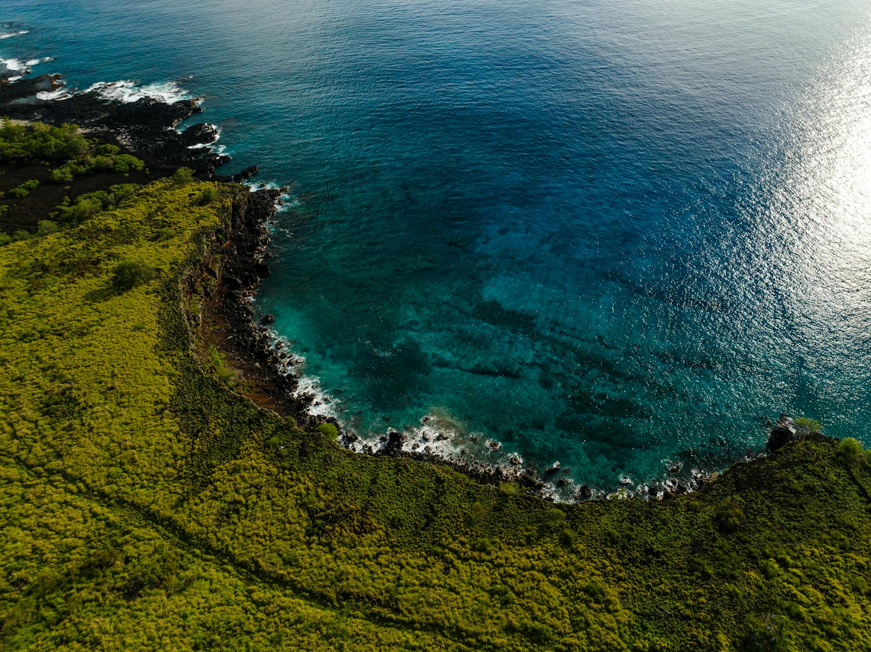
I love what a drone adds to Hawaii coverage — those Na Pali cliff lines and reef-edge aerials are unbeatable. But Hawaii is one of the most drone-restricted places I've ever flown, and the rules trip up well-meaning visitors constantly. People assume that because a spot is a famous photo location, it must be legal to fly there. Often it's the opposite — the most photogenic spots are exactly the protected ones where drones are banned.
This is a plain-English breakdown of the layers of rules, current as of 2026. Treat it as a starting point, not legal advice — regulations change, and you should verify the specific location and current rules before every flight.
The three layers of rules
Drone flying in Hawaii is governed by overlapping authorities. You have to satisfy all of them.
1. Federal (FAA) — applies everywhere
The FAA controls the airspace nationwide, including Hawaii:
- Register your drone with the FAA if it weighs more than 250 grams, and display the registration number.
- Recreational flyers must pass the free TRUST test and carry proof.
- Commercial work (anything you're paid for, or that supports a business — including selling the resulting photos) requires a Part 107 Remote Pilot Certificate.
- Standard FAA rules apply: under 400 ft, within visual line of sight, daytime (or with proper lighting), not over people, and not in controlled airspace near airports without authorization (use the B4UFLY or LAANC apps).
2. State of Hawaii — the big one
This is where most visitors get caught:
- Drones are banned in ALL Hawaii state parks. This is a blanket prohibition by the Department of Land and Natural Resources (DLNR), and it covers a huge share of the iconic coastal and waterfall spots. Wai'anapanapa, Haena, Waimea Canyon, Napali Coast State Wilderness Park, Diamond Head — all off limits.
- Flying over state-managed beaches and lands is heavily restricted, and flying over people is prohibited.
3. County and national park rules
- All national parks ban drones. That means Hawaii Volcanoes and Haleakala — no launching, landing, or operating from within park boundaries. Fines apply. (See our Volcanoes National Park day-trip guide for what you can shoot there.)
- Individual counties (Maui, Hawaii, Kauai, Honolulu) add their own restrictions on county parks and beaches.
Quick reference: can I fly here?
| Location type | Drone allowed? |
|---|---|
| Hawaii state parks | No (blanket ban) |
| National parks (Volcanoes, Haleakala) | No |
| Near airports / controlled airspace | No (without authorization) |
| Over people or crowds | No |
| Many county beaches | Often no — verify |
| Private land with owner permission | Yes |
| Unrestricted open/rural areas (uncontrolled airspace) | Often yes — verify |
Tip: Before every flight, open the FAA's B4UFLY app (or a LAANC-enabled app), check the airspace, and cross-reference whether the ground below is a state park, national park, or county-restricted area. The ground jurisdiction matters as much as the airspace.
So where can you actually fly?
It's more limited than people hope, but not impossible:
- Private property with the owner's permission — your best bet for a clean, legal flight. Many vacation rentals sit on land where, with the host's OK and clear airspace, you can fly responsibly.
- Unrestricted rural and open areas in uncontrolled airspace that aren't state parks, national parks, or near airports. These exist, especially on the larger, less-developed parts of the Big Island and rural Maui — but you must verify each one.
- With proper permits. The DLNR issues commercial film permits for some otherwise-restricted areas; if you're doing professional work, that's the route.
Because legal spots are scattered and case-by-case, I plan aerials around a specific researched location rather than assuming I'll fly wherever I land. For the islands' best ground-based aerial-style viewpoints (no drone required), see the Kauai photography guide and best Maui photography spots — many "aerial" Hawaii shots are actually taken from cliffs, helicopters, or boats.
Helicopters: the legal "aerial" workaround
When the spot you want is drone-banned (which on Kauai is most of the good stuff), a doors-off helicopter tour is the legitimate way to get the aerial. It's how the classic Na Pali and Waimea Canyon overheads are made. The Kauai photography guide covers booking and settings for flights.
How to research a spot before you fly
Because there's no single "drone map" that catches every rule, I run the same checklist for every potential launch:
- Check the airspace. Open the FAA B4UFLY app (or a LAANC app like Aloft or AirMap). Hawaii has a lot of controlled airspace around its airports — Honolulu, Kahului, Lihue, and Kona all have rings you can't fly in without authorization.
- Identify the land manager. Is the ground a state park, national park, county park, forest reserve, or private land? The DLNR's mapping tools and county park pages tell you who controls the parcel. State and national parks are automatic no-go.
- Look for posted signs and local notices. Many trailheads and beach entrances post drone prohibitions explicitly.
- Get written permission if you're flying from or over private property, and keep it on your phone.
- Check NOTAMs and TFRs for temporary restrictions — wildfires, VIP visits, and events all trigger them in Hawaii.
Tip: When in doubt, assume you can't fly. The penalties — and the goodwill cost of being "that tourist" buzzing a sacred site or a quiet beach — far outweigh any single shot. I'd rather skip a flight than risk a fine or, worse, an injured bystander.
Insurance, fines, and the commercial line
A few things visiting photographers underestimate:
- The commercial trigger is broad. If you intend to sell the footage, use it to promote a business, or post it monetized, the FAA treats it as commercial — you need a Part 107 certificate, and in restricted areas you'll often need a state or county film permit on top.
- Fines are real. Flying in a national park or a state park can bring citations, and rangers do enforce it.
- Liability insurance is worth carrying for any serious operator; a drone-over-water mishap or property damage can get expensive fast.
This is the part where "it's just a hobby drone" stops being a defense — the rules apply regardless of intent.
Etiquette and safety, beyond the law
Even where flying is legal, be a good operator:
- Never fly over people, wildlife, or sacred/cultural sites. Harassing monk seals, turtles, or nesting seabirds can carry separate federal penalties.
- Mind the wind. Coastal Hawaii has strong, gusty trades that have claimed a lot of drones over the water.
- Keep noise down near beaches and trails. Nothing turns locals against drone pilots faster than buzzing a quiet sunset.
Before you go
Pack-wise, a sub-250g drone simplifies (but does not eliminate) the rules and is easier to travel with — our travel photography gear starter pack covers what I carry. And remember that selling your footage makes it commercial, which triggers Part 107 and, in restricted areas, permits.
Island-by-island reality check
The rules are statewide, but the practical picture differs by island:
- Kauai: The most frustrating for drone pilots — nearly all the iconic terrain (Na Pali, Waimea Canyon, Haena) is protected state or wilderness land where flying is banned. Helicopters are effectively the only legal way to get those aerials.
- Big Island: The most opportunity, simply because it's huge and much of it is rural, open, and outside parks and controlled airspace — but Volcanoes National Park and the airport zones are firmly off limits.
- Maui: Mixed. Haleakala (national park) and the major state parks are out, but some rural and private-land options exist with permission.
- Oahu: The most controlled airspace in the state thanks to Honolulu's airport and military installations; assume restrictions almost everywhere near the populated south and central areas.
Hawaii's drone landscape rewards the prepared and punishes the assuming. Research the specific spot, check both the airspace and the ground jurisdiction, get permission when needed, and fly respectfully. For everything you can capture from land, browse our full gallery and fine-art prints, and see how the islands connect on the Hawaii destination hub.
Bring the trip home
Every photo on York Adventures is shot on location and available as a fine-art print. Browse the gallery to find a frame for your wall.
Stay in the Loop
Get new photos, stories & exclusive deals straight to your inbox.
Related Posts
Kauai Photography Guide: Na Pali, Waimea Canyon & Beyond
Kauai is the most cinematic of the Hawaiian islands and the hardest to photograph well. Here's how I shoot the Na Pali Coast, Waimea Canyon, and the Hanalei side without wasting the short windows of light.
Nā Pali Coast Guide: Boat, Hike & Helicopter
Three ways to experience Kauai's Nā Pali Coast — by boat, on the Kalalau Trail, or from a doors-off helicopter — compared honestly, with permits, seasons, and photo notes for each.
Haleakalā Sunrise Guide: Reservations, Timing & Photos
How to book the Haleakalā sunrise reservation, when to actually arrive, what to wear at 10,000 feet, and how to photograph the cloud sea before the crowd does.